Get the Latest in Your Inbox
Want to stay up to date on the state of the world’s forests? Subscribe to our mailing list.
Subscribe
Why are trees outside forests important?
Outside the world’s forests, trees thrive across pasturelands, along roads and in urban areas. They also play a major role in agricultural landscapes, where they sometimes mark boundaries between farms or are directly planted with crops or pastures in a system called agroforestry.Zomer et al. 2016, https://www.nature.com/articles/srep29987 and Terasaki Hart et al. 2023, https://www.nature.com/articles/s41558-023-01810-5
Trees on farms often contribute directly to ecosystem services that make cropland more productive and enhance the livelihoods of local communities. Fruit-bearing trees and trees planted for fuel and timber provide supplementary food sources and income for communities. In countries with low forest cover, TOF may be the only wood resources available to local people and can contribute up to 20 percent of rural household income.See World Bank, https://www.profor.info/sites/profor.info/files/WPS7802_0.pdf And in some developing countries, as much as two-thirds of the fuelwood consumption is gathered from TOF.Smeets and Faaij 2007, https://link.springer.com/article/10.1007/s10584-006-9163-x Agroforestry, including boundary plantings,See ECHO, https://people.umass.edu/psoil370/Syllabus-files/Agroforestry_Principles.pdf is practiced extensively throughout tropical countries, particularly developing tropical countries, and provides subsistence to more than 900 million people.Zomer et al. 2016, https://www.nature.com/articles/srep29987 Integrating trees into the agricultural landscape often increases crop yields, reduces runoff, improves soil quality and fosters greater biodiversity compared to monoculture field crops.Jose 2007, https://link.springer.com/article/10.1007/s10457-009-9229-7
Trees also line streets and shade parks in cities across the globe, removing air pollutants, mitigating urban heat islands and lowering energy bills.Livesley et al. 2016, https://acsess.onlinelibrary.wiley.com/doi/full/10.2134/jeq2015.11.0567 Urban trees can also help conserve biodiversity in densely populated areas. The city of Beijing, China, gained 81 bird species between 1987 and 2014 as a result of increased urban tree cover.Pei et al. 2018, https://www.sciencedirect.com/science/article/pii/S1618866717301711
Additionally, TOF contribute substantially to carbon sequestration and biomass stocks. For instance, in 2010, agricultural land held 45.3 billion metric tons of carbon globally, with TOF contributing over 75 percent of this carbon.Zomer et al. 2016, https://www.nature.com/articles/srep29987#Sec2 And in Bangladesh, 73 percent of the national above-ground woody biomass is estimated to be accumulated outside forests.Schnell et al. 2015, https://link.springer.com/article/10.1007/s10661-014-4197-4
As climate change intensifies, there is increasing pressure on limited land to fulfill the various demands for human settlements, food, livestock feed, fiber, fuel, carbon storage, biodiversity and other ecosystem services. This dynamic is known as the global land squeeze.See World Resources Institute, https://www.wri.org/research/global-land-squeeze-managing-growing-competition-land
At the same time, the Intergovernmental Panel on Climate Change (IPCC) estimates that all scenarios to limit global warming to 1.5°C would involve significant carbon removal from the land sector (agriculture, forestry and other land use, or AFOLU) — 950 million hectare increase in forested area by 2050 relative to 2010.See IPCC, https://www.ipcc.ch/sr15/chapter/chapter-2/
TOF, with their positive impact on productivity, biodiversity and carbon sequestration, have an important role to play in addressing and mitigating these climate challenges.
However, despite their importance, TOF have largely remained at the sidelines of conversations about forest conservation, restoration, climate change and productivity. TOF are difficult to define and are often distributed in areas where the land is used for multiple purposes, which means TOF often don’t receive the same conservation attention as forests. Yet integrating trees into existing agricultural landscapes, increasing urban tree cover and protecting sparse tree cover can result in large benefits for people and the climate.
While this indicator currently only considers the tropics, TOF thrive across the globe. However, data is currently insufficient to report adequately on status and trends related to TOF outside the tropics. Read more in the Limitations and Future Prospects section.
Less
How do we define land that contains trees outside forests?
For this indicator, land that contains TOF refers to all human-managed urban and agricultural land with tree cover and all other land with greater than zero percent and less than 10 percent tree cover. Trees in these areas may grow individually or in clusters, scattered or in linear formations, and may be managed by individuals, communities or government agencies. For this indicator, land that contains TOF must satisfy one or both of the following two criteria:
- The first criterion considers a land use and land cover classification based on the European Space Agency’s (ESA) Climate Change Initiative (CCI) data set and the Science Based Targets Network (SBTN) Natural Lands data set. In this indicator, land that contains TOF refers to land with greater than zero percent tree cover that is classified as “Agriculture” or “Settlement” in the ESA CCI data set, with no upper threshold for tree cover percent. Tree cover percentage is based on WRI’s Tropical Tree Cover (TTC) data set at half-hectare scale. In addition, in order to include most pasturelands, this criterion also includes land with greater than zero percent tree cover that is classified as both “Grassland” in the ESA CCI data set and “Non-natural” in the SBTN data set, with no upper threshold for tree cover percent.
- The second criterion considers tree cover percentage on all land cover types based on the TTC data set at half-hectare scale. For this criterion, we adapt the Food and Agriculture Organization of the United Nations (FAO) definition of forestSee FAO, https://www.fao.org/3/I8661EN/i8661en.pdf and use the following criteria: land spanning at least 0.5 hectares with at least 10 percent tree cover. Based on this, our definition of land that contains TOF includes any land with greater than zero percent and less than 10 percent tree cover.
Defining land that contains TOF can be challenging due to the complex and diverse nature of the landscapes in which TOF occur, the variability of tree cover and the lack of consistent definitions and criteria across regions and countries. Read more in the Limitations and Future Prospects section. In addition, there are other definitions of forests that are not used in this indicator — learn more on the Key Terms and Definitions page.
More
Detecting Trees Outside Forests with Tropical Tree Cover
Monitoring TOF is important for tracking land use and land cover changes as the global land squeeze intensifies. However, due to their heterogeneous distribution and complex definition, finding a single data set that offers a consistent methodology for incorporating TOF into national accounting systems is challenging, and countries often define TOF differently. Traditional field-based monitoring can be costly in terms of time and labor. The lack of standardized, affordable methods for monitoring TOF highlights the value of freely available, satellite-based remote sensing data sets that accurately capture these systems.
Previously, despite the existence of global satellite tree cover data sets, there remained considerable uncertainty about the distribution of tree cover in drylands and in areas with non-forest land use. In these ecosystems, patches of trees may cover an area smaller than individual satellite pixels. This means trees in open canopy systemsSee Oxford Reference, https://www.oxfordreference.com/display/10.1093/acref/9780198608912.001.0001/acref-9780198608912-e-4715?rskey=1dYsnY&result=4702 are often excluded by lower spatial resolution satellite-based data sets, resulting in an underestimation of tree cover.
The 10-meter Tropical Tree Cover (TTC) data set uses imagery from Sentinel-1 and Sentinel-2 satellites to map trees inside and outside of dense forests with greater granularity than previous 30-meter tree cover products based on Landsat, such as Hansen et al. (2013) and Potapov et al. (2020). Using 10-meter imagery improves our ability to quantify tree cover on non-forest lands, such as urban areas and cropland, and monitor trees at small spatial scales. The TTC data is used for all calculations in this indicator, and currently contains data for 4.35 billion hectares of the tropics (-23.44° to 23.44° latitude).
Tree cover detection at 10 and 30-meter resolution
Read More +
More
How are trees outside forests distributed throughout the tropics?
Across the tropics there are nearly 1.35 billion hectares of land that contain TOF, and the trees on those lands cover approximately 336 million hectares in total.
The distribution of land that contains TOF varies greatly across the tropics and is influenced by both anthropogenic factors, such as land use, as well as environmental conditions including water availability.
Over 50 percent of land in southern Asia, eastern Asia and western Africa is land that contains TOF, and a third or more of land in northern Africa, eastern Africa, southeast Asia, the Caribbean and southern Africa is land that contains TOF.
The subregion with the lowest proportion of land that contains TOF is Melanesia, which is still comprised of over 12 percent of land that contains TOF.
More
Distribution and proportion of land that contains TOF by subregion
More
Trees growing in cities and on farms are contributing substantially to regional tree cover, and in most tropical regions in 2020, more than half of all agricultural and urban land had >10 percent tree cover. Over 71 percent of urban land in the Caribbean and over 66 percent of cropland in Asia and Oceania has >10 percent tree cover, the highest proportions in all tropical subregions.
More
Tree cover statistics on cropland and urban land in the tropics by geographic region
More
Land cover categories were defined by the ESA CCI Land Cover map.See ESA CCI, http://maps.elie.ucl.ac.be/CCI/viewer/download/ESACCI-LC-Ph2-PUGv2_2.0.pdf For this table, “Cropland” excludes grassland pastures, and includes rainfed cropland, irrigated cropland, and the mosaic cropland and mosaic natural vegetation classes. For this calculation, "Latin America” is comprised of South America, Central America and Mexico.
More
Examples of trees outside forests
More
Agroforestry system in southwest India
More
Boundary plantings in western El Salvador
More
Urban trees in downtown in Sao Paulo
More
Dispersed dryland trees in southern Niger
More
What trees outside forests look like on the ground
More
How is tree cover outside forests changing?
Despite advancements in using 10-meter satellite imagery to detect trees in open canopy landscapes and on human-managed urban and agricultural lands, large extent change detection maps of TOF do not currently exist. In addition, current forest loss data products, such as Hansen et al. (2013), typically do not have high enough spatial resolution to detect changes in tree cover outside of forests. The WRI Global Restoration Initiative (GRI) team is working on change detection pilot projects, which will stem back to 2017 and provide insights on tree cover gain and loss to answer this question. Read more in the Limitations and Future Prospects section.
More
Forest Landscape Restoration Often Focuses on Planting TOF
Because TOF often simultaneously contribute to sequestering carbon, reducing erosion and enhancing food production, they are frequently the focus of land restoration initiatives. Forest Landscape Restoration (FLR) is the ongoing process of restoring landscapes to regain ecological functionality and enhance human well-being across deforested or degraded forest landscapes.See IUCN, https://www.iucn.org/our-work/topic/forests/forest-landscape-restoration#:~:text=Forest%20landscape%20restoration%20%28FLR%29%20is%20the%20ongoing%20process,offer%20multiple%20benefits%20and%20land%20uses%20over%20time. FLR generates a suite of ecosystem goods and services by intelligently and appropriately increasing tree cover across the landscape, balancing a mosaic of interdependent land uses. This is often accomplished by planting TOF — in some places, trees are added to agricultural lands without forming a closed canopy in order to enhance food production, reduce erosion, provide shade and produce firewood. FLR can be accomplished with a variety of interventions and seeks to restore whole landscapes to meet present and future needs, offering multiple benefits and land uses over time.
Read More +
More
Limitations and Future Prospects
Characterizing land that contains TOF is challenging for a number of reasons, so other analyses or quantifications of land that contains TOF may not rely on the same definition. Unlike forests, which are well-defined ecosystems, TOF can be found in a variety of landscapes, including agricultural fields, urban areas and degraded lands, which results in a lack of clear boundaries. TOF also encompass a wide variety of tree species, each with its own unique ecological requirements. In many areas, land is used for multiple purposes, including agriculture, urban development and industrial activities, which also makes it difficult to characterize where TOF are distributed. Lastly, because land with TOF is not always identified as an important resource and is often viewed as competing with other land uses, there is limited political will to give these areas the same conservation attention as forests. For these reasons, it is difficult to develop a standardized definition for TOF that can be applied across different regions and ecosystems.
The “land that contains TOF” definition used in this indicator is similar to the FAO definition of “Other Land with Tree Cover” in their Global Forest Resources Assessment (FRA) of 2020:See FAO, https://www.fao.org/3/I8661EN/i8661en.pdf "All land that is not classified as ’Forest‘ or ’Other wooded land,‘ spanning more than 0.5 hectares with a canopy cover of more than 10 percent of trees able to reach a height of 5 meters at maturity." However, trees in open canopy systems with greater than zero percent and less than 10 percent tree cover are also included in this indicator due to the increased spatial resolution of TTC.
At present, the TTC data set is a single-year snapshot of tree cover for the year 2020. Future research and annual TTC change detection data could have important implications for global carbon models and sustainable land management agendas, especially for geographic regions that have typically been underserved by remote sensing-based monitoring models, such as drylands and other areas with small-scale agriculture.
Less
{"Glossary":{"51":{"name":"agricultural tree crops","description":"Trees cultivated for their food, cultural, or economic values. These include oil palm, rubber, cocoa, cashew, mango, oranges (citrus), plantain, banana, and coconut.\r\n"},"141":{"name":"agroforestry","description":"A diversified set of agricultural or agropastoral production systems that integrate trees in the agricultural landscape.\r\n"},"101":{"name":"albedo","description":"The ability of surfaces to reflect sunlight.\u0026nbsp;Light-colored surfaces return a large part of the sunrays back to the atmosphere (high albedo). Dark surfaces absorb the rays from the sun (low albedo).\r\n"},"94":{"name":"biodiversity intactness","description":"The proportion and abundance of a location\u0027s original forest community (number of species and individuals) that remain.\u0026nbsp;\r\n"},"95":{"name":"biodiversity significance","description":"The importance of an area for the persistence of forest-dependent species based on range rarity.\r\n"},"142":{"name":"boundary plantings","description":"Trees planted along boundaries or property lines to mark them well.\r\n"},"98":{"name":"carbon dioxide equivalent (CO2e)","description":"Carbon dioxide equivalent (CO2e) is a measure used to aggregate emissions from various greenhouse gases (GHGs) on the basis of their 100-year global warming potentials by equating non-CO2 GHGs to the equivalent amount of CO2.\r\n"},"99":{"name":"CO2e","description":"Carbon dioxide equivalent (CO2e) is a measure used to aggregate emissions from various greenhouse gases (GHGs) on the basis of their 100-year global warming potentials by equating non-CO2 GHGs to the equivalent amount of CO2.\r\n"},"1":{"name":"deforestation","description":"The change from forest to another land cover or land use, such as forest to plantation or forest to urban area.\r\n"},"77":{"name":"deforested","description":"The change from forest to another land cover or land use, such as forest to plantation or forest to urban area.\r\n"},"76":{"name":"degradation","description":"The reduction in a forest\u2019s ability to perform ecosystem services, such as carbon storage and water regulation, due to natural and anthropogenic changes.\r\n"},"75":{"name":"degraded","description":"The reduction in a forest\u2019s ability to perform ecosystem services, such as carbon storage and water regulation, due to natural and anthropogenic changes.\r\n"},"79":{"name":"disturbances","description":"A discrete event that changes the structure of a forest ecosystem.\r\n"},"68":{"name":"disturbed","description":"A discrete event that changes the structure of a forest ecosystem.\r\n"},"65":{"name":"driver of tree cover loss","description":"The direct cause of forest disturbance.\r\n"},"70":{"name":"drivers of loss","description":"The direct cause of forest disturbance.\r\n"},"81":{"name":"drivers of tree cover loss","description":"The direct cause of forest disturbance.\r\n"},"102":{"name":"evapotranspiration","description":"When solar energy hitting a forest converts liquid water into water vapor (carrying energy as latent heat) through evaporation and transpiration.\r\n"},"2":{"name":"forest","description":"Forests include tree cover greater than 30 percent tree canopy density and greater than 5 meters in height as mapped at a 30-meter Landsat pixel scale.\r\n"},"3":{"name":"forest concession","description":"A legal agreement allowing an entity the right to manage a public forest for production purposes.\r\n"},"90":{"name":"forest concessions","description":"A legal agreement allowing an entity the right to manage a public forest for production purposes.\r\n"},"53":{"name":"forest degradation","description":"The reduction in a forest\u2019s ability to perform ecosystem services, such as carbon storage and water regulation, due to natural and anthropogenic changes.\r\n"},"54":{"name":"forest disturbance","description":"A discrete event that changes the structure of a forest ecosystem.\r\n"},"100":{"name":"forest disturbances","description":"A discrete event that changes the structure of a forest ecosystem.\r\n"},"5":{"name":"forest fragmentation","description":"The breaking of large, contiguous forests into smaller pieces, with other land cover types interspersed.\r\n"},"6":{"name":"forest management plan","description":"A plan that documents the stewardship and use of forests and other wooded land to meet environmental, economic, social, and cultural objectives. Such plans are typically implemented by companies in forest concessions.\r\n"},"62":{"name":"forests","description":"Forests include tree cover greater than 30 percent tree canopy density and greater than 5 meters in height as mapped at a 30-meter Landsat pixel scale.\r\n"},"69":{"name":"fragmentation","description":"The breaking of large, contiguous forests into smaller pieces, with other land cover types interspersed.\r\n"},"80":{"name":"fragmented","description":"The breaking of large, contiguous forests into smaller pieces, with other land cover types interspersed.\r\n"},"74":{"name":"gain","description":"The establishment of tree canopy in an area that previously had no tree cover. Tree cover gain may indicate a number of potential activities, including natural forest growth or the crop rotation cycle of tree plantations.\r\n"},"143":{"name":"global land squeeze","description":"Pressure on finite land resources to produce food, feed and fuel for a growing human population while also sustaining biodiversity and providing ecosystem services.\r\n"},"7":{"name":"hectare","description":"One hectare equals 100 square meters, 2.47 acres, or 0.01 square kilometers and is about the size of a rugby field. A football pitch is slightly smaller than a hectare (pitches are between 0.62 and 0.82 hectares).\r\n"},"66":{"name":"hectares","description":"One hectare equals 100 square meters, 2.47 acres, or 0.01 square kilometers and is about the size of a rugby field. A football pitch is slightly smaller than a hectare (pitches are between 0.62 and 0.82 hectares).\r\n"},"67":{"name":"intact","description":"A forest that contains no signs of human activity or habitat fragmentation as determined by remote sensing images and is large enough to maintain all native biological biodiversity.\r\n"},"78":{"name":"intact forest","description":"A forest that contains no signs of human activity or habitat fragmentation as determined by remote sensing images and is large enough to maintain all native biological biodiversity.\r\n"},"8":{"name":"intact forests","description":"A forest that contains no signs of human activity or habitat fragmentation as determined by remote sensing images and is large enough to maintain all native biological biodiversity.\r\n"},"55":{"name":"land and environmental defenders","description":"People who peacefully promote and protect rights related to land and\/or the environment.\r\n"},"9":{"name":"loss driver","description":"The direct cause of forest disturbance.\r\n"},"10":{"name":"low tree canopy density","description":"Less than 30 percent tree canopy density.\r\n"},"84":{"name":"managed forest concession","description":"Areas where governments have given rights to private companies to harvest timber and other wood products from natural forests on public lands.\r\n"},"83":{"name":"managed forest concession maps for nine countries","description":"Cameroon, Canada, Central African Republic, Democratic Republic of the Congo, Equatorial Guinea, Gabon, Indonesia, Liberia, and the Republic of the Congo\r\n"},"104":{"name":"managed natural forests","description":"Naturally regenerated forests with signs of management, including logging, clear cuts, etc.\r\n"},"91":{"name":"megacities","description":"A city with more than 10 million people.\r\n"},"57":{"name":"megacity","description":"A city with more than 10 million people."},"56":{"name":"mosaic restoration","description":"Restoration that integrates trees into mixed-use landscapes, such as agricultural lands and settlements, where trees can support people through improved water quality, increased soil fertility, and other ecosystem services. This type of restoration is more likely in deforested or degraded forest landscapes with moderate population density (10\u2013100 people per square kilometer). "},"86":{"name":"natural","description":"A forest that is grown without human intervention.\r\n"},"12":{"name":"natural forest","description":"A forest that is grown without human intervention.\r\n"},"63":{"name":"natural forests","description":"A forest that is grown without human intervention.\r\n"},"144":{"name":"open canopy systems","description":"Individual tree crowns that do not overlap to form a continuous canopy layer.\r\n"},"82":{"name":"persistent gain","description":"Forests that have experienced one gain event from 2001 to 2016.\r\n"},"13":{"name":"persistent loss and gain","description":"Forests that have experienced one loss or one gain event from 2001 to 2016."},"97":{"name":"plantation","description":"An area in which trees have been planted, generally for commercial purposes.\u0026nbsp;\r\n"},"93":{"name":"plantations","description":"An area in which trees have been planted, generally for commercial purposes.\u0026nbsp;\r\n"},"88":{"name":"planted","description":"A forest composed of trees that have been deliberately planted and\/or seeded by humans.\r\n"},"14":{"name":"planted forest","description":"Stand of planted trees \u2014 other than tree crops \u2014 grown for wood and wood fiber production or for ecosystem protection against wind and\/or soil erosion.\r\n"},"73":{"name":"planted forests","description":"Stand of planted trees \u2014 other than tree crops \u2014 grown for wood and wood fiber production or for ecosystem protection against wind and\/or soil erosion."},"148":{"name":"planted trees","description":"Stand of trees established through planting, including both planted forest and tree crops."},"149":{"name":"Planted trees","description":"Stand of trees established through planting, including both planted forest and tree crops."},"15":{"name":"primary forest","description":"Old-growth forests that are typically high in carbon stock and rich in biodiversity. The GFR uses a humid tropical primary rainforest data set, representing forests in the humid tropics that have not been cleared in recent years.\r\n"},"64":{"name":"primary forests","description":"Old-growth forests that are typically high in carbon stock and rich in biodiversity. The GFR uses a humid tropical primary rainforest data set, representing forests in the humid tropics that have not been cleared in recent years.\r\n"},"58":{"name":"production forest","description":"A forest where the primary management objective is to produce timber, pulp, fuelwood, and\/or nonwood forest products."},"89":{"name":"production forests","description":"A forest where the primary management objective is to produce timber, pulp, fuelwood, and\/or nonwood forest products.\r\n"},"87":{"name":"seminatural","description":"A managed forest modified by humans, which can have a different species composition from surrounding natural forests.\r\n"},"59":{"name":"seminatural forests","description":"A managed forest modified by humans, which can have a different species composition from surrounding natural forests. "},"96":{"name":"shifting agriculture","description":"Temporary loss or permanent deforestation due to small- and medium-scale agriculture.\r\n"},"103":{"name":"surface roughness","description":"Surface roughness of forests creates\u0026nbsp;turbulence that slows near-surface winds and cools the land as it lifts heat from low-albedo leaves and moisture from evapotranspiration high into the atmosphere and slows otherwise-drying winds. \r\n"},"17":{"name":"tree cover","description":"All vegetation greater than five meters in height and may take the form of natural forests or plantations across a range of canopy densities. Unless otherwise specified, the GFR uses greater than 30 percent tree canopy density for calculations.\r\n"},"71":{"name":"tree cover canopy density is low","description":"Less than 30 percent tree canopy density.\r\n"},"60":{"name":"tree cover gain","description":"The establishment of tree canopy in an area that previously had no tree cover. Tree cover gain may indicate a number of potential activities, including natural forest growth or the crop rotation cycle of tree plantations.\u0026nbsp;As such, tree cover gain does not equate to restoration.\r\n"},"18":{"name":"tree cover loss","description":"The removal or mortality of tree cover, which can be due to a variety of factors, including mechanical harvesting, fire, disease, or storm damage. As such, loss does not equate to deforestation.\r\n"},"150":{"name":"tree crops","description":"Stand of perennial trees that produce agricultural products, such as rubber, oil palm, coffee, coconut, cocoa and orchards."},"19":{"name":"tree plantation","description":"An agricultural plantation of fast-growing tree species on short rotations for the production of timber, pulp, or fruit.\r\n"},"72":{"name":"tree plantations","description":"An agricultural plantation of fast-growing tree species on short rotations for the production of timber, pulp, or fruit.\r\n"},"85":{"name":"trees outside forests","description":"Trees found in urban areas, alongside roads, or within agricultural land\u0026nbsp;are often referred to as Trees Outside Forests (TOF).\u202f\r\n"},"151":{"name":"unmanaged","description":"Naturally regenerated forests without any signs of management, including primary forest."},"105":{"name":"unmanaged natural forests","description":"Naturally regenerated forests without any signs of management, including primary forest.\r\n"}}}
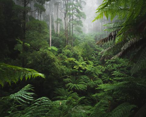
 Trees Outside Forests