Get the Latest in Your Inbox
Want to stay up to date on the state of the world’s forests? Subscribe to our mailing list.
Subscribe
What role do Indigenous Peoples and local communities play in protecting forests?
There is a strong, and growing, evidence base demonstrating that with the right enabling conditions, Indigenous Peoples and local communities are the best stewards of forestland, and that their rights are crucial to protecting the world’s remaining tropical forests. The IPCC has repeatedly recognized the authority of these scientific findings and called for Indigenous and other local community management as a critical solution to the climate crisis. A 2023 study billed as the “largest and most comprehensive review yet of how to stop deforestation” distilled findings from 320 peer-reviewed analyses and found that since 2018, the amount of research demonstrating that deforestation is lower on Indigenous lands has more than doubled. This meta-analysis focused particularly on the role of Indigenous Peoples, but also concluded that community forestry slowed forest loss in South Asia and Mexico.
Analyses using data on LandMark have also concluded that:
- Indigenous and community lands in Brazil, Peru, Mexico and Colombia sequestered more than double the amount of carbon per hectare than other areas.
- Forests managed by Indigenous Peoples in the Amazon were strong net carbon sinks from 2001-2021, collectively removing 340 million tonnes of carbon dioxide (CO2) — the equivalent of the United Kingdom’s entire annual emissions from fossil fuels. Meanwhile, forests outside Indigenous territories were collectively a carbon source due to significant forest loss.
- Between 2013 and 2023, the percentage of tree cover loss outside of Indigenous and community lands in Brazil and Peru (two heavily forested countries with publicly available official community land maps) was higher than within.
However, forests in Indigenous territories may be at risk. For example, in 2023, Indigenous and community lands in Brazil lost 105,000 hectares of forest, an area nearly the size of Hong Kong. Proposed legislation in Brazil during the Bolsonaro administration would allow extractive industries and infrastructure projects in Indigenous territories and weaken Indigenous and traditional communities' claims to forests, and as of mid-2024 has not been formally withdrawn by the Lula administration.
Tree cover loss is lower inside Indigenous and community lands in Peru and Brazil than outsideSee Data and Methods
More
How much forestland is held by Indigenous Peoples and other forest-dependent local communities?
An estimated 2.5 billion Indigenous Peoples, local communities and Afro-descendant peoples customarily hold and use 50 percent of the world’s land. It is estimated that between one-fifth and one-third of the world’s remaining intact forest landscapes are on Indigenous land. At least 36 percent of the global Key Biodiversity Areas (KBAs) lie within Indigenous Peoples and local community lands. This indicator includes lands under the customary stewardship of Indigenous Peoples, local communities and Afro-descendant peoples, regardless of whether official title is conferred or rights are recognized under statutory law.
More
Mapping Indigenous and Community Lands with LandMark
Spatial data on the boundaries and location of lands held by Indigenous Peoples, local communities and Afro-descendant peoples is often, but not always, limited or inaccessible to those outside of these communities. One global source of spatial data on Indigenous and community lands (both lands that have been recognized in formal law and those that have not) is LandMark, which has published maps of Indigenous and community lands that collectively cover more than 13 percent of the world’s land. Most of the available data is in North and South America, parts of Southeast Asia, southern Africa, Iran and Australia.
The LandMark data set includes approximately 136,000 Indigenous and community land maps and indicative areas. These areas contain approximately 21 percent of the world’s intact forest landscapes.
Though the data compiled by LandMark represents only a fraction of the world’s Indigenous and community lands, analysis of the available spatial data yields insights into how formal tenure might impact deforestation trends in these lands, and what is at stake in protecting them, as further explored below.
Although mapping of Indigenous and community lands can support recognition and defense of these lands and enable enforcement of legal rights, mapping is also a political and politicized act; geospatial data released in the public domain should be carefully considered and should have buy-in from the communities since some information may be sensitive. All of the Indigenous and community land maps on LandMark, which are also available on Global Forest Watch, are publicly available or were granted permission through a data-sharing agreement.
Read More +
More
How much forestland is legally recognized for Indigenous Peoples and other local communities?
Legal recognition of Indigenous Peoples and local communities’ forestland rights grew in the 2000s and 2010s. In a 2018 study by the Rights and Resources Initiative (RRI), which included 58 countries covering nearly 92 percent of global forest area, Indigenous Peoples and local communities were legally recognized as owning at least 447 million hectares (Mha) of forestland and having legally designated rights (see box below for how this term is defined) over an additional 80 Mha, for a total of 14 percent of global forest area, as of 2017. Analysis of a subset of 41 of these countries shows an increase in the amount of forested land owned by or designated for Indigenous Peoples and local communities over time, from 11 percent in 2002 to 15 percent in 2017, representing a 40 percent increase. The majority of the gains in forest area legally recognized for Indigenous Peoples and local communities from 2002-2017 has been in low- and middle-income countries.
More
Forest ownership and rights are divided between governments, communities, private individuals and firms<fn>Ginsburg and Keene 2018, <a href="https://rightsandresources.org/wp-content/uploads/2019/03/At-A-Crossroads_RRI_Nov-2018.pdf">https://rightsandresources.org/wp-content/uploads/2019/03/At-A-Crossroads_RRI_Nov-2018.pdf</a>.</fn>
More
Forestland owned by or designated for communities increased from 2002 to 2017<fn>Ginsburg and Keene 2018, <a href="https://rightsandresources.org/wp-content/uploads/2019/03/At-A-Crossroads_RRI_Nov-2018.pdf">https://rightsandresources.org/wp-content/uploads/2019/03/At-A-Crossroads_RRI_Nov-2018.pdf</a>.</fn>
More
The Bundle-of-Rights Approach
RRI has monitored legal recognition of Indigenous Peoples and local community rights to forestland since 2002, tracking both quantitative and qualitative aspects of rights. Their bundle-of-rights approach, originally developed by Elinor Ostrom, classifies forest tenure according to the rights-holder and specific legal entitlements recognized by national-level laws and regulations, as follows:
- Government administered: Forestland is legally claimed as exclusively belonging to the state, including concessions on state-owned lands. Governments may recognize communities’ rights to access forestlands and/or withdraw forest resources.
- Designated for Indigenous Peoples and local communities: Statutory law recognizes Indigenous Peoples and local communities’ rights to access and withdraw, as well as at least management of forests and/or exclusion of outsiders. Other rights may be conferred, but communities do not have the full bundle of rights associated with ownership.
- Owned by Indigenous Peoples and local communities: Statutory law recognizes Indigenous Peoples and local communities’ rights of access, withdrawal, management and exclusion, with the addition of due process and compensation for an unlimited duration. Alienation rights (through sale, lease or use as collateral) are not required.
- Privately owned by individuals and firms: Individuals and firms legally hold the full bundle of rights described in #3 above for an unlimited duration, as well as the right to sell forestland.
Legal analysis itself does not shed light on the extent to which rights are realized on the ground by communities — in other words, the extent of secure tenure. With secure tenure, communities can exercise rights autonomously and enforce such rights when they are under threat. Analysis at the tenure regime level also does not shed light on whether titles are held. (While title is less crucial to secure tenure than the ability to exercise rights, it does not in and of itself confer tenure, and is often a separate process.)
Read More +
More
Based on these figures and a scoping study of opportunities for further legal recognition of Indigenous Peoples and local communities’ forestland rights, the Path to Scale network has set a target of securing an additional 150 Mha of tropical forestland by 2025 and at least 400 Mha by 2030 of tropical forestland designated for use and/or owned by Indigenous Peoples and local communities, raising the total area of forestland owned or designated for use by Indigenous Peoples and local communities in low- and middle-income countries to over 50%.
More
Limitations and Future Prospects
Maps created and/or endorsed by communities are important for spatial planning and land use decision making, both within the communities themselves and for external stakeholders. Maps enable communities to delineate the boundaries of their ancestral lands and can be a useful tool to support protecting and recognizing legitimate rights to forests. They also can be presented as evidence to support reducing conflict from overlapping land claims. Additionally, community land maps have been used to understand the impacts of tenure systems on natural assets, such as biodiversity and carbon storage. Increasingly, Indigenous and community land maps are also being used by risk assessors working for companies or their investors to understand risks, such as whether there are conflicting claims over lands that they wish to invest in.
However, Indigenous Peoples, local communities and Afro-descendant peoples are often unwilling to share their geospatial data publicly, and with good reason. Historically, maps have been used by vested interests including the governments, private industry and colonizers to justify taking of land, resulting in direct harm to Indigenous Peoples, local communities and Afro-descendants, and in some cases exacerbating conflict, particularly when community maps are seen as illegitimate compared to “official” (i.e., government) data. In addition, rightsholders may be wary because their ways of knowing and conceptualizing their territories are not covered in most geospatial tools. Therefore, lack of data should not be interpreted as indicating the absence of communities. It is essential to ensure that mapping efforts are led by or co-designed with communities themselves and are respectful of communities’ data security and sovereignty.
More
{"Glossary":{"51":{"name":"agricultural tree crops","description":"Trees cultivated for their food, cultural, or economic values. These include oil palm, rubber, cocoa, cashew, mango, oranges (citrus), plantain, banana, and coconut.\r\n"},"141":{"name":"agroforestry","description":"A diversified set of agricultural or agropastoral production systems that integrate trees in the agricultural landscape.\r\n"},"101":{"name":"albedo","description":"The ability of surfaces to reflect sunlight.\u0026nbsp;Light-colored surfaces return a large part of the sunrays back to the atmosphere (high albedo). Dark surfaces absorb the rays from the sun (low albedo).\r\n"},"94":{"name":"biodiversity intactness","description":"The proportion and abundance of a location\u0027s original forest community (number of species and individuals) that remain.\u0026nbsp;\r\n"},"95":{"name":"biodiversity significance","description":"The importance of an area for the persistence of forest-dependent species based on range rarity.\r\n"},"142":{"name":"boundary plantings","description":"Trees planted along boundaries or property lines to mark them well.\r\n"},"98":{"name":"carbon dioxide equivalent (CO2e)","description":"Carbon dioxide equivalent (CO2e) is a measure used to aggregate emissions from various greenhouse gases (GHGs) on the basis of their 100-year global warming potentials by equating non-CO2 GHGs to the equivalent amount of CO2.\r\n"},"99":{"name":"CO2e","description":"Carbon dioxide equivalent (CO2e) is a measure used to aggregate emissions from various greenhouse gases (GHGs) on the basis of their 100-year global warming potentials by equating non-CO2 GHGs to the equivalent amount of CO2.\r\n"},"1":{"name":"deforestation","description":"The change from forest to another land cover or land use, such as forest to plantation or forest to urban area.\r\n"},"77":{"name":"deforested","description":"The change from forest to another land cover or land use, such as forest to plantation or forest to urban area.\r\n"},"76":{"name":"degradation","description":"The reduction in a forest\u2019s ability to perform ecosystem services, such as carbon storage and water regulation, due to natural and anthropogenic changes.\r\n"},"75":{"name":"degraded","description":"The reduction in a forest\u2019s ability to perform ecosystem services, such as carbon storage and water regulation, due to natural and anthropogenic changes.\r\n"},"79":{"name":"disturbances","description":"A discrete event that changes the structure of a forest ecosystem.\r\n"},"68":{"name":"disturbed","description":"A discrete event that changes the structure of a forest ecosystem.\r\n"},"65":{"name":"driver of tree cover loss","description":"The direct cause of forest disturbance.\r\n"},"70":{"name":"drivers of loss","description":"The direct cause of forest disturbance.\r\n"},"81":{"name":"drivers of tree cover loss","description":"The direct cause of forest disturbance.\r\n"},"102":{"name":"evapotranspiration","description":"When solar energy hitting a forest converts liquid water into water vapor (carrying energy as latent heat) through evaporation and transpiration.\r\n"},"2":{"name":"forest","description":"Forests include tree cover greater than 30 percent tree canopy density and greater than 5 meters in height as mapped at a 30-meter Landsat pixel scale.\r\n"},"3":{"name":"forest concession","description":"A legal agreement allowing an entity the right to manage a public forest for production purposes.\r\n"},"90":{"name":"forest concessions","description":"A legal agreement allowing an entity the right to manage a public forest for production purposes.\r\n"},"53":{"name":"forest degradation","description":"The reduction in a forest\u2019s ability to perform ecosystem services, such as carbon storage and water regulation, due to natural and anthropogenic changes.\r\n"},"54":{"name":"forest disturbance","description":"A discrete event that changes the structure of a forest ecosystem.\r\n"},"100":{"name":"forest disturbances","description":"A discrete event that changes the structure of a forest ecosystem.\r\n"},"5":{"name":"forest fragmentation","description":"The breaking of large, contiguous forests into smaller pieces, with other land cover types interspersed.\r\n"},"6":{"name":"forest management plan","description":"A plan that documents the stewardship and use of forests and other wooded land to meet environmental, economic, social, and cultural objectives. Such plans are typically implemented by companies in forest concessions.\r\n"},"62":{"name":"forests","description":"Forests include tree cover greater than 30 percent tree canopy density and greater than 5 meters in height as mapped at a 30-meter Landsat pixel scale.\r\n"},"69":{"name":"fragmentation","description":"The breaking of large, contiguous forests into smaller pieces, with other land cover types interspersed.\r\n"},"80":{"name":"fragmented","description":"The breaking of large, contiguous forests into smaller pieces, with other land cover types interspersed.\r\n"},"74":{"name":"gain","description":"The establishment of tree canopy in an area that previously had no tree cover. Tree cover gain may indicate a number of potential activities, including natural forest growth or the crop rotation cycle of tree plantations.\r\n"},"143":{"name":"global land squeeze","description":"Pressure on finite land resources to produce food, feed and fuel for a growing human population while also sustaining biodiversity and providing ecosystem services.\r\n"},"7":{"name":"hectare","description":"One hectare equals 100 square meters, 2.47 acres, or 0.01 square kilometers and is about the size of a rugby field. A football pitch is slightly smaller than a hectare (pitches are between 0.62 and 0.82 hectares).\r\n"},"66":{"name":"hectares","description":"One hectare equals 100 square meters, 2.47 acres, or 0.01 square kilometers and is about the size of a rugby field. A football pitch is slightly smaller than a hectare (pitches are between 0.62 and 0.82 hectares).\r\n"},"67":{"name":"intact","description":"A forest that contains no signs of human activity or habitat fragmentation as determined by remote sensing images and is large enough to maintain all native biological biodiversity.\r\n"},"78":{"name":"intact forest","description":"A forest that contains no signs of human activity or habitat fragmentation as determined by remote sensing images and is large enough to maintain all native biological biodiversity.\r\n"},"8":{"name":"intact forests","description":"A forest that contains no signs of human activity or habitat fragmentation as determined by remote sensing images and is large enough to maintain all native biological biodiversity.\r\n"},"55":{"name":"land and environmental defenders","description":"People who peacefully promote and protect rights related to land and\/or the environment.\r\n"},"9":{"name":"loss driver","description":"The direct cause of forest disturbance.\r\n"},"10":{"name":"low tree canopy density","description":"Less than 30 percent tree canopy density.\r\n"},"84":{"name":"managed forest concession","description":"Areas where governments have given rights to private companies to harvest timber and other wood products from natural forests on public lands.\r\n"},"83":{"name":"managed forest concession maps for nine countries","description":"Cameroon, Canada, Central African Republic, Democratic Republic of the Congo, Equatorial Guinea, Gabon, Indonesia, Liberia, and the Republic of the Congo\r\n"},"104":{"name":"managed natural forests","description":"Naturally regenerated forests with signs of management, including logging, clear cuts, etc.\r\n"},"91":{"name":"megacities","description":"A city with more than 10 million people.\r\n"},"57":{"name":"megacity","description":"A city with more than 10 million people."},"56":{"name":"mosaic restoration","description":"Restoration that integrates trees into mixed-use landscapes, such as agricultural lands and settlements, where trees can support people through improved water quality, increased soil fertility, and other ecosystem services. This type of restoration is more likely in deforested or degraded forest landscapes with moderate population density (10\u2013100 people per square kilometer). "},"86":{"name":"natural","description":"A forest that is grown without human intervention.\r\n"},"12":{"name":"natural forest","description":"A forest that is grown without human intervention.\r\n"},"63":{"name":"natural forests","description":"A forest that is grown without human intervention.\r\n"},"144":{"name":"open canopy systems","description":"Individual tree crowns that do not overlap to form a continuous canopy layer.\r\n"},"82":{"name":"persistent gain","description":"Forests that have experienced one gain event from 2001 to 2016.\r\n"},"13":{"name":"persistent loss and gain","description":"Forests that have experienced one loss or one gain event from 2001 to 2016."},"97":{"name":"plantation","description":"An area in which trees have been planted, generally for commercial purposes.\u0026nbsp;\r\n"},"93":{"name":"plantations","description":"An area in which trees have been planted, generally for commercial purposes.\u0026nbsp;\r\n"},"88":{"name":"planted","description":"A forest composed of trees that have been deliberately planted and\/or seeded by humans.\r\n"},"14":{"name":"planted forest","description":"Stand of planted trees \u2014 other than tree crops \u2014 grown for wood and wood fiber production or for ecosystem protection against wind and\/or soil erosion.\r\n"},"73":{"name":"planted forests","description":"Stand of planted trees \u2014 other than tree crops \u2014 grown for wood and wood fiber production or for ecosystem protection against wind and\/or soil erosion."},"148":{"name":"planted trees","description":"Stand of trees established through planting, including both planted forest and tree crops."},"149":{"name":"Planted trees","description":"Stand of trees established through planting, including both planted forest and tree crops."},"15":{"name":"primary forest","description":"Old-growth forests that are typically high in carbon stock and rich in biodiversity. The GFR uses a humid tropical primary rainforest data set, representing forests in the humid tropics that have not been cleared in recent years.\r\n"},"64":{"name":"primary forests","description":"Old-growth forests that are typically high in carbon stock and rich in biodiversity. The GFR uses a humid tropical primary rainforest data set, representing forests in the humid tropics that have not been cleared in recent years.\r\n"},"58":{"name":"production forest","description":"A forest where the primary management objective is to produce timber, pulp, fuelwood, and\/or nonwood forest products."},"89":{"name":"production forests","description":"A forest where the primary management objective is to produce timber, pulp, fuelwood, and\/or nonwood forest products.\r\n"},"87":{"name":"seminatural","description":"A managed forest modified by humans, which can have a different species composition from surrounding natural forests.\r\n"},"59":{"name":"seminatural forests","description":"A managed forest modified by humans, which can have a different species composition from surrounding natural forests. "},"96":{"name":"shifting agriculture","description":"Temporary loss or permanent deforestation due to small- and medium-scale agriculture.\r\n"},"103":{"name":"surface roughness","description":"Surface roughness of forests creates\u0026nbsp;turbulence that slows near-surface winds and cools the land as it lifts heat from low-albedo leaves and moisture from evapotranspiration high into the atmosphere and slows otherwise-drying winds. \r\n"},"17":{"name":"tree cover","description":"All vegetation greater than five meters in height and may take the form of natural forests or plantations across a range of canopy densities. Unless otherwise specified, the GFR uses greater than 30 percent tree canopy density for calculations.\r\n"},"71":{"name":"tree cover canopy density is low","description":"Less than 30 percent tree canopy density.\r\n"},"60":{"name":"tree cover gain","description":"The establishment of tree canopy in an area that previously had no tree cover. Tree cover gain may indicate a number of potential activities, including natural forest growth or the crop rotation cycle of tree plantations.\u0026nbsp;As such, tree cover gain does not equate to restoration.\r\n"},"18":{"name":"tree cover loss","description":"The removal or mortality of tree cover, which can be due to a variety of factors, including mechanical harvesting, fire, disease, or storm damage. As such, loss does not equate to deforestation.\r\n"},"150":{"name":"tree crops","description":"Stand of perennial trees that produce agricultural products, such as rubber, oil palm, coffee, coconut, cocoa and orchards."},"19":{"name":"tree plantation","description":"An agricultural plantation of fast-growing tree species on short rotations for the production of timber, pulp, or fruit.\r\n"},"72":{"name":"tree plantations","description":"An agricultural plantation of fast-growing tree species on short rotations for the production of timber, pulp, or fruit.\r\n"},"85":{"name":"trees outside forests","description":"Trees found in urban areas, alongside roads, or within agricultural land\u0026nbsp;are often referred to as Trees Outside Forests (TOF).\u202f\r\n"},"151":{"name":"unmanaged","description":"Naturally regenerated forests without any signs of management, including primary forest."},"105":{"name":"unmanaged natural forests","description":"Naturally regenerated forests without any signs of management, including primary forest.\r\n"}}}
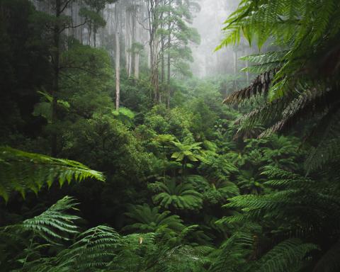
 Indigenous and Community Forests